+91-9354322614
apoorva@rbt-ltd.com
S&M Office
4 Adchini, Mehrauli Road, Delhi-110017
Office Timings
Mon - Sat: 9.30 to 18.00
Get A Quote
Home
Services
Ground Penetrating Radar Survey
Electronic Pipe Line Locator Survey
3D Panaromic Survey
Drone Survey
DGPS Survey
Training Courses
Enterprise & Project Management
AgilePM® Foundation and Practitioner
Professional Scrum Master™ (PSM-I)
Professional Scrum Master™ II (PSM II)
PROFESSIONAL SCRUM PRODUCT OWNER™ (PSPO)
PROFESSIONAL SCRUM™ WITH KANBAN (PSK)
PROFESSIONAL AGILE LEADERSHIP ESSENTIALS™ (PAL-E)
TOGAF® BUSINESS ARCHITECTURE
TOGAF® EA COURSE – FOUNDATION
TOGAF® EA COURSE – PRACTITIONER
Software Training
Principles of website development
Complete SEO Training
Drone Pilot Training
DGCA Certified Drone Pilot Training
Drone Survey & Mapping
Survey Hardware Training
DGPS Training
GPR Training
About Us
Contact
Become More
Strategic.
Every single research is focused
to enhance your strategic decision-making.
More About RBT
Get trained in
Business Management,
Software & Hardware.
Leading edge technology implementation
for faster and precise data processing.
More About Trainings
Faster Data
Processing
Leading edge technology implementation
for faster and precise data processing.
More About RBT
Services
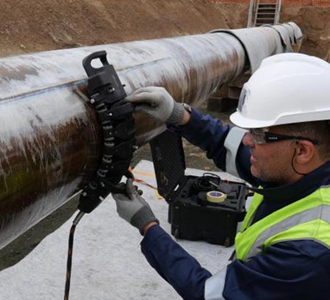
Ground, 3D panaromic and aerial surveys
Trainings
In management, hardware, software solutions
Solving complex engineering problems
to commercial timescales.
Quick Response
Faster turnaround time for precise decision-making.
Experience Team
We are committed
to innovation .
Best Data Availability
Lowers cost and
ensures reduced risk.
Tailored Support
Widest range of solutions
adapted to your needs.
Know More
The best choice for all your
business needs
With 10 Years of Experience
RB technology is a startup aimed to provide best in class engineering consultancy services to its clients.
Our Target
Reduce TAT and increase precision.
Our Strenth
Credible team with experience.
Know More
Our Services
Ground Penetrating
Radar Survey
Read More
Ground Penetrating
Radar Survey
It is a very powerful survey system to map underground utilities.
Read More
Electronic Pipe Line
Locator Survey
Read More
Electronic Pipe Line
Locator Survey
It is a humble but a versatile tool to quickly identify metal lines running parallely to each other.
Read More
3D Panaromic
Survey
Read More
3D Panaromic
Survey
3 D Panoramic Survey is done for asset management along the route.
Read More
Drone
Survey
Read More
Drone
Survey
It is the most helpful tool in capturing topographic dataup to five times faster
Read More
DGPS
Survey
Read More
DGPS
Survey
DGPS surveys are a gold standard for any industry which requires survey either.
Read More
Our process
01
Contract
First step of process
02
Discussion
Our second easy step
03
Execution
Important third step
04
Result
Solution in final step